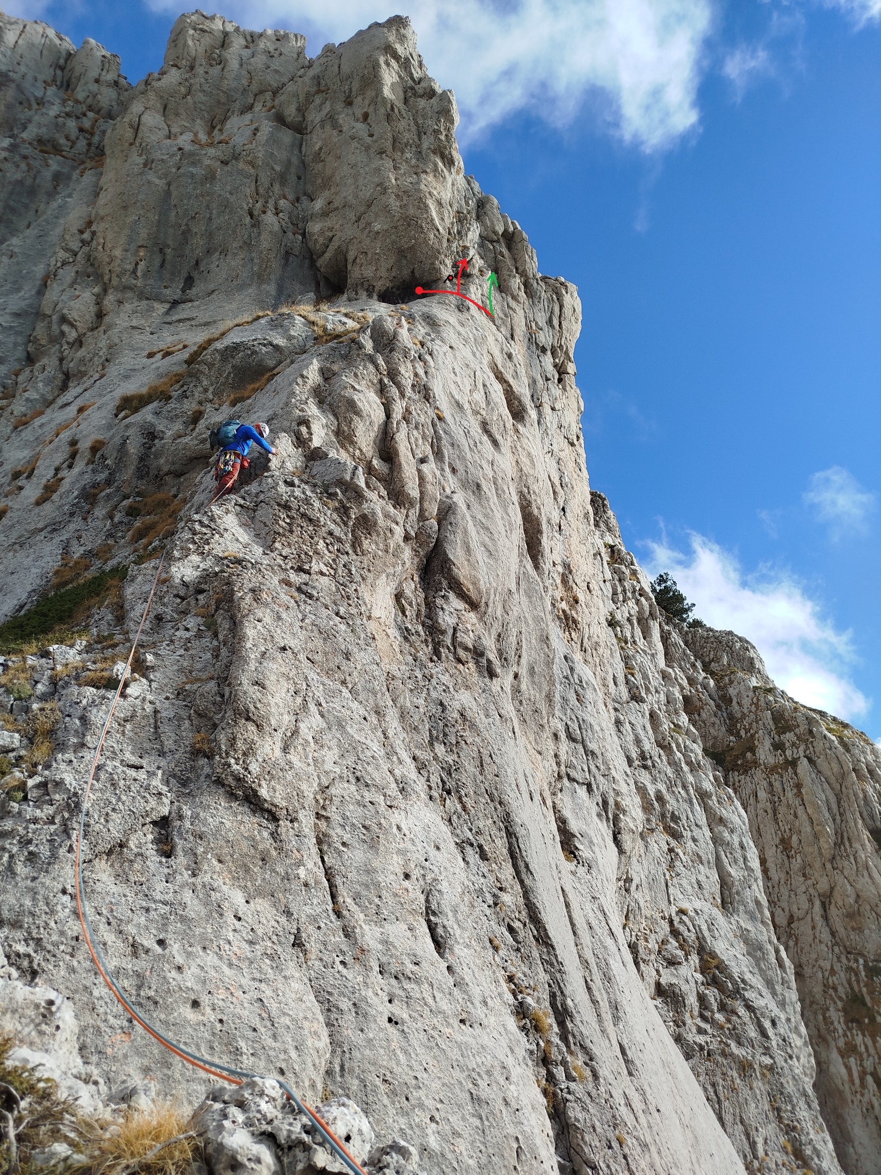
The first ascent of the route “Pulsed exit” (VI, 150m) was realized on 12/6/2004 by G. Stathopoulos - I. Moysidis - Chr. Avgitas.
The 1st pitch starts on a pillar to the left side of which there is a demanding dihedral, while on its right side there is an easy gully. The belay is set on a spike.
The 2nd pitch starts with walking on the ridge until the sloping slab and then it follows an easy arête and slabs which finally lead to a characteristic hollow (cave), under a big overhang, where the belay is set, equipped with a bolt.
The 3rd pitch begins with a traverse for 3m and then it follows a series of dihedrals until the ledge where the belay is set.
The 4th pitch moves on a frictionless slab (VI), which is the crux of the route, and finally ends by following an easy arête. An easier way out is the narrow chimney and the dihedral to the left.
A variation of the 3rd pitch (VI+, 30m) was established on 2/11/2025, by D. Giounis - Chr. Zionos. This variation starts from the 2nd belay station inside the cave and moves right via a traverse, passing the piton located just below the start of the standard route's dihedral, and continues for another 3m to a small hole. Directly above this hole and with a slight overhang, begins a solid dihedral (VI+) with sparse protection at the start (one poor small nut followed by one good, larger piece slightly higher up), featuring beautiful, exposed climbing on relatively good holds that become easier (with more protection options) as we ascend. Once the dihedral ends, the route moves left through another dihedral (V+) that takes good protection with friends (Camalot #0.5 and #0.75), leading to a distinctive fist crack which also accepts friends (Camalot #3 and #4) and leads leftward across broken, blocky terrain (IV/IV-) until reaching a grassy area, where a belay is set up on small rock spikes at approximately 55m. From there, we continue walking along a beautiful but exposed ridge for 200m to the summit, and return via the return path.
To access the base of the route, we follow a dirt road that starts from the northern end of the village of Skamneli and is relatively passable, so that a tall car is sufficient, without the need for a 4x4. The dirt road, heading generally north, leads to the south of Gkoura, to a point with a red mark on a rock (39.938901, 20.856018), which marks the path for Gkoura - Tsouka Rossa - Megala Litharia. The crag begins to be visible after a few meters on the path and we move towards it, steadily in a northerly direction, arriving in approximately 1.5hrs.
Information about the route can also be found here.
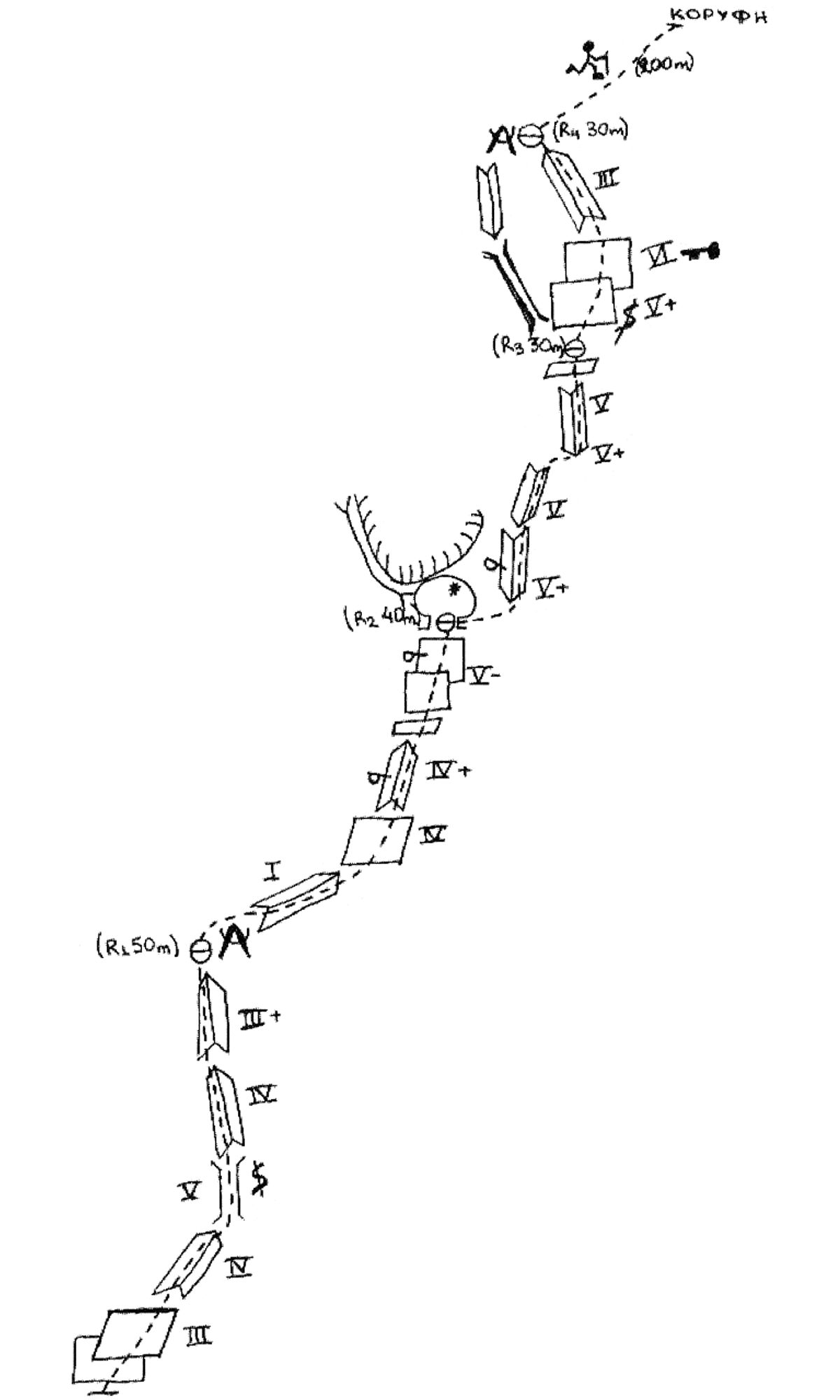
Sketch of the route.
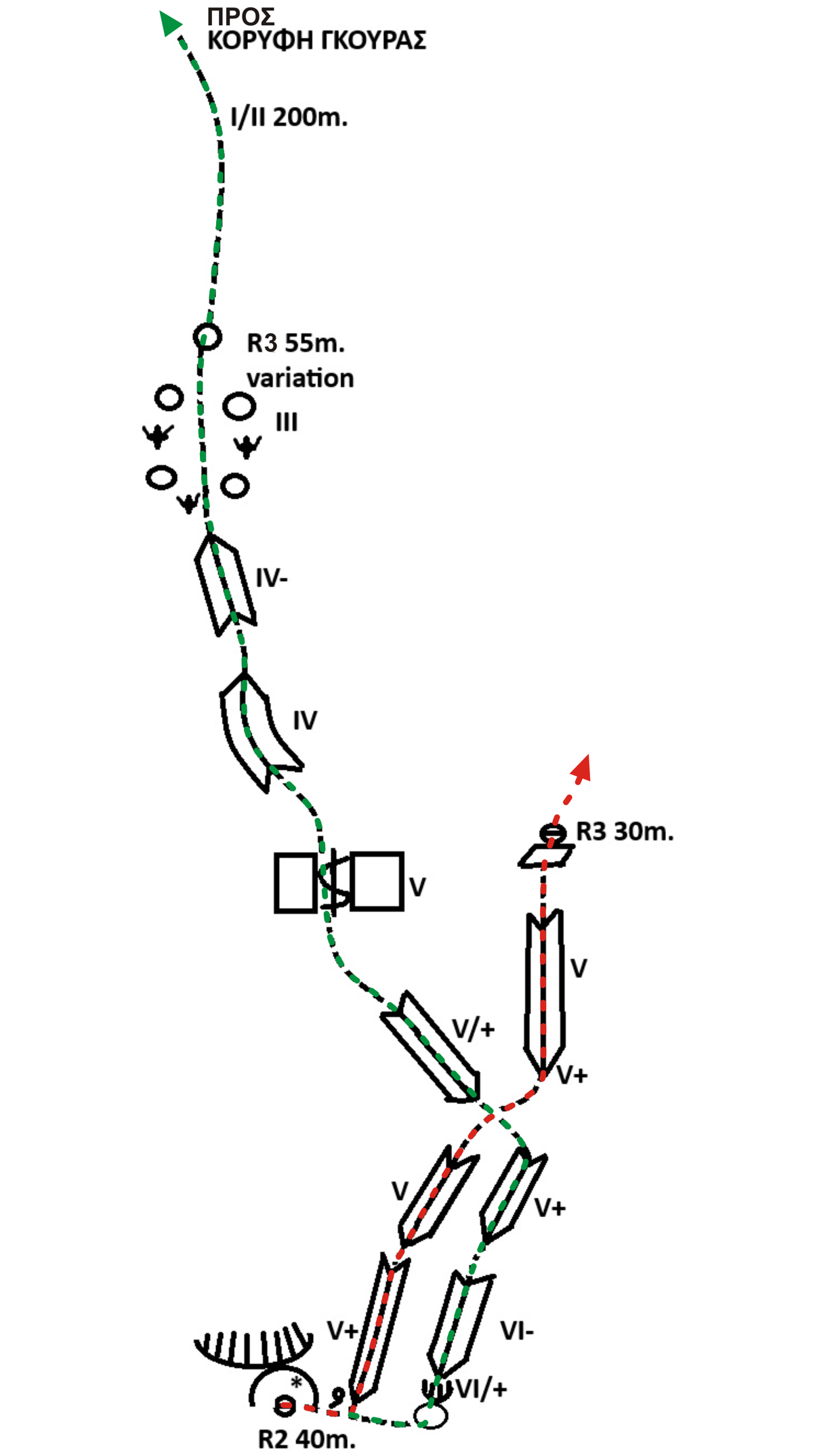
Sketch of the route's 3rd pitch (red) and the variation (green).